Research Article - (2025) Volume 15, Issue 3
Received: 03-Aug-2025, Manuscript No. JCDE-25-168654;
Editor assigned: 06-Aug-2025, Pre QC No. JCDE-25-168654 (PQ);
Reviewed: 20-Aug-2025, QC No. JCDE-25-168654;
Revised: 03-Oct-2025, Manuscript No. JCDE-25-168654 (R);
Published:
10-Oct-2025
, DOI: 10.37421/2165-784X.2025.15.601
Copyright: © 2025 Jagirani SS, et al. This is an open-access article distributed under the terms of the creative commons attribution license which permits unrestricted use, distribution and reproduction in any medium, provided the original author and source are credited.
Landslides and rock avalanches greatly influence livelihood, ecosystem, and are considered to be a vulnerable form of natural disaster. Northern regions of Pakistan, comprising of rugged mountains are home to a number of disasters including landslides. This study describes the susceptibility of landslide processes in the Shigar district of Gilgit Baltistan, which is considered to be a hotspot of natural hazards, and uses the Analytical Hierarchy Process (AHP) technique to develop a methodology for evaluating and modeling landslide data. Field findings and results of this study identified that the occurrence of these events is impacted by a range of natural and anthropogenic factors, such as earthquakes, which shake and disturb the strength of formations, and continuous heavy rainfall, which increase the susceptibility of soil to erode and damage the connectivity between rocks and boulders. The effects of various landslide-triggering factors (geology, slope, aspect, land cover, road network, fault line, and river) are evaluated. Landslides are identified during the field investigation, confirmed by Shigar's local people and compared to the inventory map of landslides. Based on the landslide susceptibility analysis results, 64 percent of the area falls into the low LSI class, followed by the moderate susceptibility class at 28 percent and the high susceptibility category at 8%. The susceptibility map for landslides is used to forecast the spatial probability and can be used to design preventative actions for landslides in the Shigar district.
Analytical Hierarchy Process (AHP) • Geographical Information System (GIS) • Landslides susceptibility • Shigar valley • Pakistan
Pakistan, a developing country vulnerable to natural disasters such as earthquakes, landslides, floods, and avalanches, presents considerable challenges in disaster management [1,2]. The 2010 Atta Abad landslide provides as a harsh reminder of the disastrous repercussions, killing 19 people, displacing over 6,000 others, and forming a 14-kilometer lake that drowned important infrastructure, including sections of the Karakoram Highway [3]. Despite the prevalence of such incidents, the region lacks comprehensive terrain landslide susceptibility maps, which are critical for risk assessment and mitigation [4]. Landslides continue to be one of the most damaging geohazards worldwide, and sophisticated countries have created susceptibility maps, [5], using conventional approaches like the Analytical Hierarchy Process (AHP) and newer machine learning techniques like Support Vector Machines (SVMs), [6]. This study examines these limitations by creating high-resolution landslide susceptibility maps for the Shigar valley, a location with steep slopes, harsh terrain, and vulnerability to triggers such as seismic activity and excessive rainfall [7]. By combining traditional AHP methodologies with sophisticated machine learning models such as SVM, the study compares the performance of different methods to determine the most dependable framework for local applications [8]. Furthermore, this study uses a detailed investigation of causative factors such as slope morphology, valley-fill sediments, and moraine complexes to increase forecast accuracy [9]. The importance of valley-fill sediments and barrier breaches is highlighted, providing new insights into their effects on slope instability and landslide behavior [10,11]. By filling a major gap in landslide susceptibility mapping in Pakistan, this study not only improves local disaster resilience but also helps to a better knowledge of landslide dynamics, particularly in resource-constrained, high-risk areas [12].
Study area
The study area situated along the bank of the Shigar river and a spectacular area of the Karakoram region [13]. The entire area is 8,500 square kilometers with a total population of 109,000 people (Figure 1). The importance of landslide hazards mitigation came after the huge landslide event in the Karakoram region, which took place in 2010 and was named Attabad landslide [14-16].

Figure 1. Location map of the present research: (a) Pakistan, (b) Gilgit-Baltistan, (c) study area.
Geological features play a critical role in landslide management, significantly influencing slope stability. Understanding the geological characteristics of an area is essential for assessing landslide risk and implementing effective mitigation strategies [17]. Geotechnical features of geological formations and their link to landslide events are based on geotechnical characteristics, structural joints and discontinuities, hydrogeological behavior, and indirect control of soil depth, with vegetation concealing erosion processes [18]. Table 1 lists the specifics of each Lithological Training Unit. Landslides are becoming more common as geological and tectonic formations (MKT), come closer spatially [19].
Landslide inventory map
A landslide inventory map illustrates the position and distribution of landslides that have previously happened in different time and space [20]. As a first step in creating a landslide inventory map, the locations and distribution of previous landslides within the study area were marked (Figure 2).

Figure 2. The landslide inventory map of the study area is presented, with (A1) depicting a large rock. Additionally, (B1) shows a photograph taken during the field visit to the study area.
Field investigations
Field studies were conducted through on-site visits, measurements, and observations to gather comprehensive data on landslides. The collected data were later used to validate the outcomes of spatial analysis performed on the inventory map. This validation ensured the map accurately represented the landscape's vulnerability to landslides by assessing its accuracy, reliability, and associated thematic layers. Detailed investigations were carried out at strategically selected sites within the mass-wasting areas, supported by extensive photographic documentation. These efforts utilized 1:200,000 scale geological maps, advanced high-resolution cameras, and a handheld Magellan GPS to precisely capture the surficial and internal sedimentary features of these geological events.
Spatial distribution maps of the causative factors
For assessing the landslide hazard and its evolution in the study area, the following data sets are used to process and acquire the required information for mapping the spatial distribution of various chosen landslide-influencing factors and interpreting the geospatial results (Table 1). For the Digital Elevation Model (DEM), used from the https://earthexplorer.usgs.gov/ are utilized to create spatial distribution maps for various factors in the study area, including slope, aspect, elevation, lithology, land use and land cover, distance to roads, and distance to faults. DEM is utilized in landslide susceptibility and hazard assessment studies due to its ability to provide detailed information about the elevation of the Earth’s surface.
Additionally, DEM facilitates the derivation of various topographic indexes such as slope angle and various slope aspects, aiding the assessment of assessing terrain susceptibility to landslides [21]. Furthermore, by integrating DEM with other thematic layers such as land use, lithology, and distance to infrastructure, enables the identification of landslide-prone areas through spatial analysis and informs decision-making processes related to land use planning and risk mitigation. Overall, DEM serves as a foundational dataset that provides valuable insights into terrain characteristics, contributing significantly to the comprehensive assessment of landslide susceptibility and risk. This enabled us to assess the impact of landslides in each of these thematic categories. To estimate the number of pixels with a resolution of 30 × 30 meters, all the thematic layers have been converted into rasters, and each raster has been reclassified into different groups. The methodology to prepare each thematic layer from Landsat images and DEM are given in the (Table 1).
| Data | Source | Description | Website/data portal |
| Satellite image | Sentinel 2 | Download | https://earthexplorer.usgs.gov/ |
| Sentinel 1 | Download | https://www.usgs.gov/ | |
| Topographical data | DEM | Used to derive other thematic data layers such as aspect and slope | https://search.asf.alaska.edu/ |
| Elevation | Derived from DEM | Sentinel-1 DEM | |
| Slope | Derived from DEM | Sentinel-1 DEM | |
| Aspect | Derived from DEM | Sentinel-1 DEM | |
| Land cover | Derived from sentinel 2 | Sentinel 2 imagery | |
| Distance to fault | Digitized from geological map of Pakistan | Geological map of Pakistan (Searle and Khan 1996) | |
| Distance to road | Extracted from Khan S, et al. (2014) | Soil survey of Pakistan | |
| Distance to river/stream | Extracted from Khan S, et al. (2014) | Soil survey of Pakistan | |
| Landslides inventory | Google Earth | Landslide events within the study area mapped using Google Earth imagery and verified through field survey | https://earthobservatory.nasa.gov/ |
Table 1. Sources of data used for the study.
All layers are combined using factor weights and sub-factors computed using the method to generate the map of landslides susceptibility. All thematic layers have been integrated into the geospatial environment in ArcGIS 10.5 using a mix of Weighted Linear Combination (WLC) method and processed using AHP. The Euclidian distance in ArcGIS10.5 spatial analysis tools were used to identify and create the thematic layers of distance to faults and roads. The five most common land cover classes [22], identified in the study area using a Sentinel-2 satellite pictures from 2020 are as follows such as forests, agricultural land, urban areas, water bodies, and barren land. The land use map was created using the probability of supervised categorization technique in ArcGIS 10.5 software. Of satellite data to extract topographical data such as slope level, slope appearance, and elevation, a sentinal-1 12.5 m digital elevation model from the https://asf.alaska.edu/datasets/daac/sentinel-1, was utilized [23]. The Area Under the Curve (AUC) method is a statistical tool for assessing the performance of landslide susceptibility models by calculating the area beneath the Receiver Operating Characteristic (ROC) curve [24]. This technique assesses the model's capacity to differentiate between landslide-prone and non-landslide-prone locations, with higher AUC values indicating more model accuracy and predictive capability [25]. The Pair Comparison Matrix (PCM) method assesses and ranks factors influencing landslide risk using a qualitative approach [26,27]. PCM involves systematically comparing pairs of factors, such as slope angle, soil type, vegetation cover, and hydrological conditions, to assess their relative importance. The process starts by identifying relevant factors, followed by pairwise comparisons to determine the influence of each factor on landslide susceptibility [28].
Methods
Analytical Hierarchy Process (AHP) in landslides susceptibility analyses: Once the component inclinations were validated, the values of each Pair Comparison Matrix (PCM) column are added together. The mean factor qualities were determined as the average of the qualities in each column in each row by dividing the values in each matrix cell by the total of the same factor column. Here average values to the advantage of each line, these average values were used as upward values of each factor's weight [29]. As indicated in the center column (y) of the table the demand for each component is determined based on the weight estimations obtained (Table 2).
| Comparison | Slope | Lithology | Distance to stream | Plan curvature | Distance to road | Distance to fault | Aspect | Land cover |
| Slope | 1 | 1 | 3 | 4 | 5 | 5 | 7 | 9 |
| Lithology | 1 | 1 | 3 | 3 | 3 | 3 | 4 | 5 |
| Distance to stream | 1/3 | 1/3 | 1 | 3 | 4 | 5 | 5 | 5 |
| Plan curvature | ¼ | 1/3 | 1/3 | 1 | 3 | 4 | 5 | 5 |
| Distance to road | 1/5 | 1/3 | 1/4 | 1/3 | 1 | 3 | 3 | 5 |
| Distance to fault | 1/5 | 1/3 | 1/5 | ¼ | 1/3 | 1 | 3 | 3 |
| Aspect | 1/7 | ¼ | 1/5 | 1/5 | 1/3 | 1/3 | 1 | 3 |
| Land cover | 1/9 | 1/5 | 1/5 | 1/5 | 1/5 | 1/3 | 1/3 | 1 |
Table 2. Matrix showing the couple comparison of the factors influencing landslide.
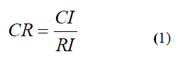
Finally, a Consistency Ratio (CR) for the comparison matrix in pairs has been produced by comparing the consistency Index (CI) with the average Random Consistency Index (RI) to check the degree of consistency of relative weights, as shown in (Table 3).
|
N |
1 |
2 |
3 |
4 |
5 |
6 |
7 |
8 |
9 |
10 |
|
RI |
0 |
0 |
0.52 |
0.89 |
1.11 |
1.25 |
1.35 |
1.4 |
1.45 |
1.49 |
Table 3. Random consistency index.
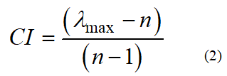
The random consistency index is RI, and the consistency index is CI, both of which are expressed as Eq (2). The following formula is used to calculate the Consistency Ratio (CR):
When λmax is the maximum value of the matrix;
n=Number of parameters participating.
As indicated in Table 4, Saaty had been using a randomly generated reciprocal matrix featuring scales of 1/9, 1/8, 1, 8, 9 to estimate a random consistency index (RI) [30].
Landslides Susceptibility Index (LSI): The final Landslides Susceptibility Index (LSI) map was generated using the following formula after the reference score was normalized and weights have been calculated: [31-33]
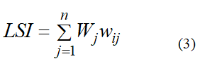
The weights for each of the landslides conditioning variables are Wij, and the classification classes for each layer are WJ. Natural breakages were utilized to create class intervals on a map of landslides susceptibility, and the LSI map was divided into three categories (low, moderate, high). Where Wj is the parameter j's weight value;
wij=nominal value or class I weight in parameter j;
n=the number of parameters.
AHP-weighted information: The four primary variables influence the majority of the landslides (i.e., geological factors, land and landforms, hydrological factors, and anthropogenic factors). As a layer of GIS categorization function such as lithology, distance from faults, land cover, slope, aspect, plan curvature, distance from streams, and distance from roads. The inconsistency is allowed if the CR (Consistency Ratio) value is below or equivalent to 0.1, whereas the AHP model was automatically refused if the CR value was more than 0.1. The weighted linear summation model was adopted to employ acquired weights. The weights have also been utilized to create a model of landslides susceptibility.
Validation of results: The validation of susceptibility to landslides in our work was done with two different input data sets: a map of susceptibility to previously produced landslides and data from land landslides occurrences in the study region, which had never been used in vulnerability analysis before. In order to evaluate the results, the Area Under Curve (AUC) tool is employed which is a graphical representation of binary operating classes (True Positive Rate (TPR) and False Positive Rate (FPR)) which determines the accuracy of project. The TPR represents truly predicted events while FPR indicates falsely taken events.
It is also significant to find out and evaluate the relevant causative elements and create a geospatial database to accurately estimate the regions prone to landslides. Consequently, this study chose slope angle, geology, land cover, slope aspect, distance to roads, distance to faults, curvature, and distance to river as evaluation components. Each component splits into subclasses, and both factors and subclasses were chosen based on a thorough examination of the literature, enlarged field observations. All layers are initially accessible in vector or raster formats before being changed to a raster layout with a spatial resolution of 30 meters. Topographical variables are the most critical geomorphological elements that affect slope stability. For the current research, the slope map is created using the DEM with 30 m resolution and further classified into five classes i.e., >45 degree, 45-30 degree, <30 degree, greater than 45-degree class has a substantial impact on slope instability and is more susceptible to mass movement, whereas the slope angle with less than 30 degrees is regarded as a low susceptible region for mass movement, as shown in (Figure 3a).
The slope aspect reveals the potential consequences of prevailing winds on various weather conditions and solar radiation incidents. Based on infiltration capacity, which is governed by slope angle, soil characteristics (conductivity and porosity), and plant cover, the soil becomes saturated faster based on the factors that, depending on local demands, receive higher quantities or severe precipitation. The slope aspect was classified into nine groups i.e., flat, north, north-west, east, southeast, southwest, west, north-west, and north (Figure 3b). The curvature expresses the topographic shape in such a way that the positive curvature represents the surface where the pixels are convex, and the negative ones denote the surface at which the pixels are concave. Curvature is a form of slope, defined as the curvature of a flow line formed by the intersection of the Earth's surface with a vertical plane (Figure 3c). Landslides are more probable when the value is negative, and vice versa. The zero value shows the surface with no slope and is straight or flat in the plan curvature map. Distance to road also plays a vital role in landslide susceptibility mapping, as the road construction comprises extensive excavations, vegetation removal and steep slopes. Landslides are triggered by the existence of a road owing to changes in slope stress and stability caused by undercutting, changes in hydrological conditions, and drainage. To investigate its impact in this study, the distance to roads map is classified into six buffer zones with an interval of 500-meter (Figure 3). The closeness to road increases the susceptibility of region to landslides, whereas, moving away from the roads has a less impact on the mass movement events.

Figure 3. (a) The slope angle with less than 30 degree is regarded as low susceptible region for mass movement, (b) The slope aspect was classified into ten groups, like flat, north, north-west, east, southeast, southwest, west, north-west, and north, (c) The curvature of a flow line formed by the intersection of the Earth's surface with a vertical plane, (d) Distance to vector layer and distances to roads proximity owing to the high susceptible region while, move away from the distance to road has a less impact on the mass movement events in the study area.
Landslides are common in areas of geological fault because underlying rock resistance worsens due to tectonic rupture activities (Figure 4g). The fault buffers are categorized into five groups using a geological map as a base map to produce a fault map with an interval of 500 m distance using the Euclidean distance tool (Figure 4).The closeness of streams can produce substantial erosion (gully erosion), undercuts the valleys and is regarded as predictor of landslides. The distance to stream map of this research was created using the Arc Hydro tools in the GIS environment which is further classified into six buffer classes as shown in (Figure 4f). Increased distance between streams reduces the risk of landslides, while going close to stream networks the possibility of landslide increases. Landcover map was prepared in the current research by using the Landsat-8 images with the help of maximum likelihood classification. The landcover map was further classified into five classes, namely Barren land, snow cover, water bodies, vegetation, and built-up (Figure 4 and Table 4).
| Factor | Class | Class weight | Factor weight | λmax | C | Cr |
| Slope (°) | 0-5 | 0.03 | 0.29 | 5.469 | 0.1173 | 0.0754 |
| 5-15 | 0.05 | |||||
| 15-30 | 0.14 | |||||
| 30-45 | 0.45 | |||||
| 40-60 | 0.17 | |||||
| >60 | 0.16 | |||||
| Aspect | Flat | 0.02 | 0.02 | 9.4239 | 0.053 | 0.0365 |
| North | 0.4 | |||||
| Northeast | 0.03 | |||||
| East | 0.05 | |||||
| Southeast | 0.09 | |||||
| South | 0.15 | |||||
| Southwest | 0.23 | |||||
| West | 0.23 | |||||
| Northwest | 0.15 | |||||
| Plan Curvature | -129.92 - -100.14 | 0.4200 | 0.05 | 6.2636 | 0.0527 | 0.0425 |
| -100.13 - -50.93 | 0.3000 | |||||
| -50.92 --25.81 | 0.0500 | |||||
| -25.80- -0.28 | 0.0300 | |||||
| -0.27-3.40 | 0.0800 | |||||
| 3.41-135.68 | 0.12 | |||||
| Lithology | A/B (Gl) | 0.38 | 0.21 | 5.469 | 0.1173 | 0.0754 |
| C-D (Pm, Dg, K2 g, KB) | 0.27 | |||||
| C (C, NKt, SKm, Tr, Y) | 0.16 | |||||
| D (Ec, Ca, Gm, Hg, MGg) | 0.1 | |||||
| E (Cv, Cg, Bg, HPU) | 0.06 | |||||
| F (Q) | 0.03 | |||||
| Land cover | Barren land | 0.48 | 0.087 | 4.0862 | 0.0029 | 0.0319 |
| Snow cover | 0.14 | |||||
| Water bodies | 0.07 | |||||
| Built-up area | 0.05 | |||||
| Vegetation cover | 0.25 | |||||
| Distance to road (m) | 0-500 | 0.38 | 0.05 | 6.1187 | 0.0237 | 0.0192 |
| 500-1000 | 0.25 | |||||
| 1000-1500 | 0.16 | |||||
| 1500-2000 | 0.1 | |||||
| 2000-2500 | 0.06 | |||||
| >2500 | 0.04 | |||||
| Distance to drainage (m) | 0-500 | 0.38 | 0.2 | 6.1187 | 0.02 | 0.1915 |
| 500-1000 | 0.25 | |||||
| 1000-1500 | 0.16 | |||||
| 1500-2000 | 0.1 | |||||
| 2000-5000 | 0.06 | |||||
| >5000 | 0.04 | |||||
| Distance to fault (m) | 0-500 | 0.35 | 0.15 | 4.1801 | 0.06 | 0.0667 |
| 500-1000 | 0.24 | |||||
| 1000-1500 | 0.2 | |||||
| 1500-2000 | 0.14 | |||||
| 2000-2500 | 0.1 | |||||
| >2500 | 0.06 |
Table 4. Calculation of the AHP-weighted information contents of the landslides-affecting factors.

Figure 4. The fault buffers were categorized into five groups using a (e and g) geological map as a base map to produce a fault map, (f) The closeness of streams can produce substantial erosion (gully erosion), undercuts the valleys and is regarded as predictor of landslides, (h) The land cover map show the five classes, namely barren land, snow cover, water bodies, vegetation, and built-up area in the study area.
The LSI map is categorized into three classes: Low, moderate, and high susceptibility regions (Figure 5). According to the conclusions, 8% of the region is classified as having low Landslide Susceptibility Index (LSI), 28% is classified as moderate susceptibility, and 64% falls into the high susceptibility category.

Figure 5. Show the landslide events overlaid over the Landslide Susceptibility Index (LSI) distribution map.
Accuracy assessment of the results
The AUC is generated by comparing TPR and FPR, taking FPR on x-axis while TPR on y-axis. This is done by identifying landslide locations in the field followed by taking GPS points. Total 65 points were taken in the field for validation purposes, showing different types of landslides. These points are taken as True Positive Rate (TPR) and compared with False Positive Rate (FPR) developed by AHP tool in ArcGIS software. Graphical representation of AUC explains the accuracy of mapping the area under the curve results yielded a value of 0.794. Since this value is significantly higher than the threshold of 0.5, it indicates that the model accurately predicts landslide susceptibility (Figure 6).

Figure 6. Geographical representation of fare under curve (AUC) map of the study area.
During this study, a total of 46 landslides, occurring from 2015 to 2023, were identified and systematically cataloged in the landslide inventory [34]. These incidents happened in just 70% of the research region. It is also the area where the vast majority of people in the region live. The relationship between the distribution of landslides over susceptibility categories and the pattern of susceptibility categories in the research region. The validation process has been complicated by the presence of landslides data throughout many regions of the research area. Slope instability and susceptible mapping analysis are integral parts of risk management to lower the level of landslides. Understanding landslide cycles and subsequent attempts to create susceptibility mapping offers critical information on scene advancement and reducing the threat posed by landslides. After creating a landslides inventory map, seven layers were evaluated lithology, curvature, slope, land cover, distance from the flow, fault line, and road distance. To confirm that the aims were feasible, the landslide susceptibility map was compared to the landslides inventory. The findings indicated a substantial connection between active landslides zones and the map's high and high vulnerability categories [35,36]. The researchers concluded that the AHP approach can provide higher accuracy when a strong ability accurately establishes the field parameters. Validation approaches often demarcate susceptibility maps to landslides, assuming that future landslides occur in the same areas as past ones.
Remote sensing and Geographic Information Systems (GIS) are used to create an inventory of landslides, investigate their spatial pattern, and map landslides susceptibility in this research. An inventory of landslides is generated determined by visual interpretation of Google Earth's data, which is then confirmed in the field [37]. When the landslides inventory was compared to the landslide’s causative variables, it was revealed that the roads and slope angle are the most important factors governing the spatial distribution of landslides in the region. A fault line and joint lithology also drive the geographical distribution of landslides. Landslides are also an issue in the region's infertile area and drained agricultural land. As they approach near roadways and rivers, landslides become more powerful. Interested institutions can use the produced susceptibility map to plan and manage landslides risk responses [38].
The Shigar area in Northern Pakistan was studied to identify potential landslide hazard zones. In the current research the effect of various factors was quantified based on AHP analysis. These factors include slope, aspect, lithology, and distance to fault, distance to road, and distance to stream, plan curvature, and land use. Slope has been regarded as the highest weightage factor (0.29) and the more triggering factor for landslide occurrences followed by lithology and distance to stream. In contrast, land cover is the least contributing factor. According to the results of landslides susceptibility analysis, 64 percent of the Shigar district falls within the low LSI category, follows by moderate susceptible at 28%, and elegance at 8%. These guides can be considered a base guide for landslides' hazard assessment to prevent or decrease future risks effects and further develop choice before any advancement in this district requiring comprehensive analysis. Results obtained are valuable for clarifying the molding factors for setting off landslides, in this manner, supporting the endeavors to relieve future risks in the examination region.
Surih Sibaghatullah Jagirani: Writing–review and editing, writing–original draft, visualization, validation, software, methodology, formal analysis, data curation, conceptualization. Muhammad Shafiq: Review and editing, visualization, validation, formal analysis, data curation. Muhammad Hassaan Agheem: Review and editing, data curation and supervision. Liu Weming: Writing–original draft, visualization, validation, supervision, software, resources, methodology, investigation, conceptualization.
The authors declare that they have no con�ict of interest.
The authors would like to thank the editors and the anonymous referees for their insightful and constructive comments that have led to an improved version of this paper. The authors extend their appreciation to team members Irshad Ali Zardari, Zohaib Akbar, Mir Mujtaba Laghari, Shamsa Kanwal, and Yang Zewen for their assistance in checking the language. Surih Sibaghatullah Jagirani is a recipient of the ANSO Scholarship 2021 for PhD studies.
[Crossref] [Google Scholar] [PubMed]
Journal of Civil and Environmental Engineering received 1798 citations as per Google Scholar report


