Perspective - (2025) Volume 14, Issue 4
Received: 01-Jul-2025, Manuscript No. mcce-26-190177;
Editor assigned: 03-Jul-2025, Pre QC No. P-190177;
Reviewed: 17-Jul-2025, QC No. Q-190177;
Revised: 22-Jul-2025, Manuscript No. R-190177;
Published:
29-Jul-2025
, DOI: 10.37421/2470-6965.2025.14.411
Citation: Rossi, Isabella. ”GIS: Enhancing Malaria Outbreak Prediction With Real-time Data.” Malar Contr Elimination 14 (2025):411.
Copyright: © 2025 Rossi I. This is an open-access article distributed under the terms of the Creative Commons Attribution License, which permits unrestricted use, distribution and reproduction in any medium, provided the original author and source are credited.
Geographic Information Systems (GIS) coupled with real-time data streams represent a formidable strategy for forecasting malaria outbreaks. This integrated approach allows for the identification of high-risk geographical areas and time periods by incorporating epidemiological data, climatic variables such as temperature and rainfall, environmental factors including vegetation cover and water bodies, and patterns of human mobility. Consequently, this enables proactive public health interventions, such as targeted vector control measures and public health messaging, to effectively mitigate the impact of malaria before it escalates into widespread epidemics [1].
The incorporation of mobile phone data for tracking human movement significantly enhances the precision of malaria outbreak prediction when combined with GIS and environmental data. Understanding population dynamics and movement across endemic regions allows for more accurate forecasting of disease spread. This enhanced predictive capability is crucial for timely resource allocation and the effective deployment of preventative measures [2].
Real-time weather data, particularly temperature and humidity, are identified as critical drivers influencing the life cycle of the Anopheles mosquito, the primary vector for malaria transmission. High-resolution climate models, when integrated into GIS platforms, can provide crucial early warnings of environmental conditions that are favorable for an increase in mosquito populations. This, in turn, signals a heightened risk of malaria transmission [3].
Satellite imagery, which provides essential data on land use, vegetation indices, and surface water bodies, serves as a valuable complement to GIS-based malaria prediction models. Observed changes in these environmental factors can indicate shifts in habitat suitability for mosquitoes or alter human exposure patterns. Such alterations can significantly influence the potential for malaria outbreaks [4].
The efficacy of GIS-driven malaria prediction models is fundamentally dependent on the quality and timeliness of the input data. Robust data collection systems, which include real-time reporting from health facilities and ongoing mobile surveillance efforts, are therefore indispensable for the development of accurate and responsive predictive tools. Without high-quality, timely data, the predictive power of these models is severely compromised [5].
Machine learning algorithms, when synergistically integrated with GIS and real-time data, demonstrate a remarkable ability to identify complex patterns and non-linear relationships that might elude traditional statistical methods. This capability significantly improves the accuracy of malaria outbreak predictions. These advanced models can effectively learn from historical data to forecast future trends with enhanced precision [6].
Socioeconomic factors, encompassing aspects like population density, access to healthcare services, and prevailing housing conditions, also exert a considerable influence on malaria transmission risk. The integration of these variables into GIS-based models, alongside environmental and human mobility data, provides a more holistic and comprehensive understanding of the potential for malaria outbreaks [7].
The real-time nature of data acquisition is of paramount importance for effective predictive modeling in infectious disease surveillance. Whether the data originates from mobile health applications, distributed weather sensors, or established disease surveillance systems, minimizing delays in data collection is critical. Such promptness is essential for the efficacy of early warning systems designed to detect and respond to malaria outbreaks [8].
Geospatial analysis offers a powerful methodology for identifying malaria transmission 'hotspots,' thereby enabling the precise pinpointing of areas where interventions are likely to yield the most significant impact. By enabling the visualization of disease incidence, environmental suitability for vectors, and population density, public health officials are empowered to make more informed and strategic decisions regarding resource allocation [9].
The inherently dynamic nature of malaria transmission necessitates the development of predictive models capable of continuous updating with real-time data. This iterative process, involving the input of new data, the refinement of model parameters, and the subsequent interpretation of outputs, is absolutely crucial for maintaining the accuracy and ongoing relevance of malaria outbreak predictions over time [10].
Geographic Information Systems (GIS), when augmented with real-time data streams, offer a potent methodology for anticipating malaria outbreaks. This integrated framework facilitates the identification of high-risk geographical locales and temporal windows through the assimilation of epidemiological information, climatic variables such as temperature and precipitation, environmental elements including vegetation and water bodies, and human movement patterns. Consequently, this enables the implementation of proactive public health interventions, such as precisely targeted vector control programs and public health advisories, to effectively diminish the burden of malaria before it escalates into widespread epidemics [1].
The integration of mobile phone data for the purpose of tracking human movement significantly elevates the accuracy of malaria outbreak predictions when combined with GIS and environmental data. Comprehending the movement of populations across endemic territories allows for more precise forecasting of disease dissemination. This enhanced predictive capacity is vital for the timely allocation of resources and the effective deployment of preventive strategies [2].
Real-time weather data, specifically concerning temperature and humidity, are recognized as crucial determinants of the Anopheles mosquito's life cycle, which is the primary vector for malaria. Advanced climate models, when incorporated into GIS platforms, can provide essential early alerts regarding environmental conditions conducive to an increase in mosquito populations. This, in turn, indicates an elevated risk of malaria transmission [3].
Satellite imagery, furnishing data on land utilization, vegetation indices, and surface water, acts as a valuable complement to GIS-based malaria prediction systems. Observable alterations in these environmental characteristics can signal modifications in the suitability of habitats for mosquitoes or affect patterns of human exposure. Such modifications possess the potential to influence the likelihood of outbreaks [4].
The effectiveness of GIS-driven malaria prediction models is contingent upon the quality and timeliness of the data fed into them. Therefore, robust data collection mechanisms, encompassing real-time reporting from healthcare facilities and ongoing mobile surveillance, are essential for constructing accurate and responsive predictive instruments. Inadequate or delayed data compromises the predictive power of these systems [5].
Machine learning algorithms, when integrated with GIS and real-time data, possess the capacity to discern intricate patterns and non-linear associations that might be overlooked by conventional statistical approaches, thereby improving the precision of malaria outbreak forecasts. These sophisticated models can leverage historical data to predict future trends with greater accuracy [6].
Socioeconomic determinants, including population density, accessibility to healthcare, and housing standards, also play a substantial part in the risk of malaria transmission. The incorporation of these factors into GIS-based models, alongside environmental and mobility data, provides a more comprehensive understanding of outbreak potential [7].
The real-time aspect of data is indispensable for accurate predictive modeling in the surveillance of infectious diseases. Whether sourced from mobile health platforms, environmental sensors, or public health reporting systems, minimizing data acquisition delays is critical for the effectiveness of early warning systems aimed at detecting and responding to malaria outbreaks [8].
Geospatial analysis enables the identification of 'hotspots' of malaria transmission, thereby assisting in the precise localization of areas where interventions are most likely to be effective. By visualizing disease incidence, environmental favorability for vectors, and population distribution, public health authorities are better equipped to make informed decisions regarding the allocation of resources [9].
The inherently dynamic nature of malaria transmission necessitates the development of predictive models that can be continuously updated with real-time data. This cyclical process, involving data input, model refinement, and output interpretation, is fundamental to maintaining the accuracy and relevance of outbreak predictions over time [10].
Malaria outbreak prediction is significantly enhanced by the integration of Geographic Information Systems (GIS) with real-time data streams. This approach leverages epidemiological, climatic, and environmental data, along with human mobility patterns, to identify high-risk areas and periods. Proactive interventions can then be implemented to mitigate disease impact. The inclusion of mobile phone data for tracking human movement further refines predictions, allowing for more accurate forecasting of disease spread and effective resource allocation. Real-time weather data is crucial for understanding mosquito vector dynamics, while satellite imagery provides insights into land use and habitat suitability. The accuracy of these GIS-driven models is heavily reliant on the quality and timeliness of input data, necessitating robust collection systems. Machine learning algorithms further improve prediction accuracy by identifying complex patterns. Socioeconomic factors also play a role and should be incorporated into models. The real-time nature of data is paramount for effective early warning systems, and geospatial analysis helps pinpoint intervention hotspots. Continuous updating of dynamic predictive models with real-time data is essential for maintaining accuracy and relevance.
None
None
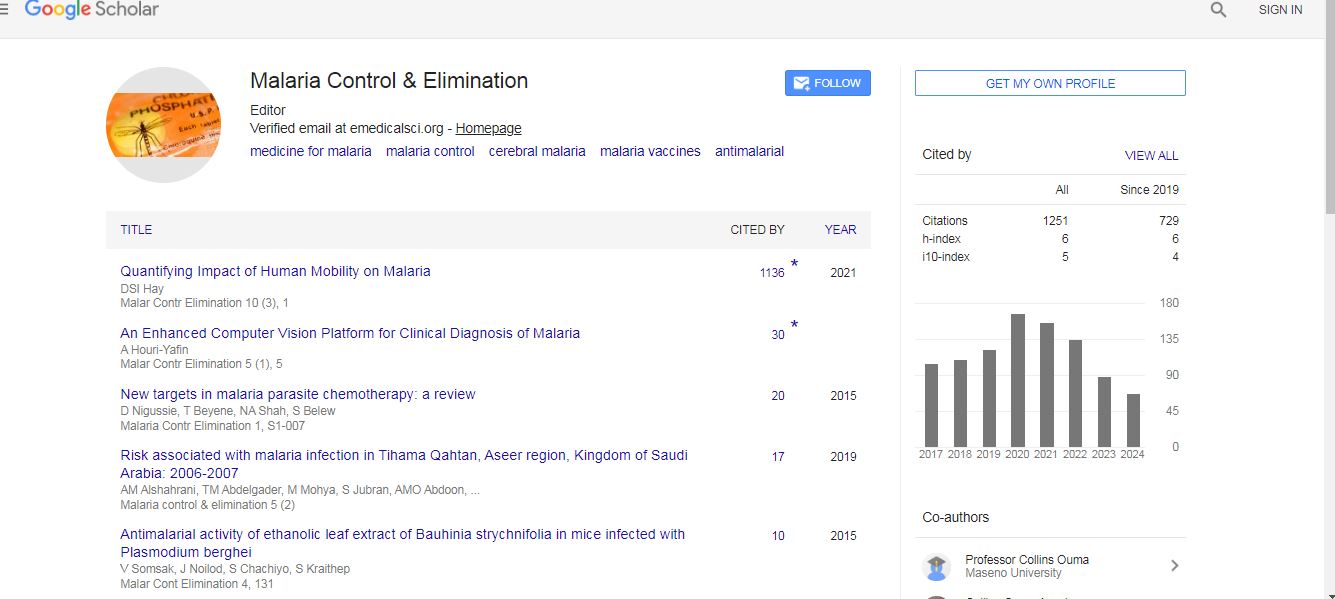
Malaria Control & Elimination received 1187 citations as per Google Scholar report