Research Article - (2020) Volume 10, Issue 5
Received: 02-Aug-2020
Published:
26-Aug-2020
, DOI: 10.37421/jcce.2020.10.358
Citation: Dagne, Habtamu Tamiru and Meseret Wagari Bortola. “Assessment of Stormwater Drainage System for Small Urban Watershed: A
Case of Shambu Town, Oromia Region, Ethiopia.” Civil Environ Eng 10 (2020):
358 doi: 10.37421/jcce.2020.10.358
Copyright: © 2020 Dagne HT et al. This is an open-access article distributed under the
terms of the Creative Commons Attribution License, which permits unrestricted
use, distribution, and reproduction in any medium, provided the original author
and source are credited.
Stormwater runoff in a small urban watershed is one of the major challenging issues facing many countries where financial capacity is very weak to provide sufficient drainage systems. This study aims to assess the stormwater drainage system in the small urban watershed as a case study of Shambu town, Oromia Region, Ethiopia. The main objective of this study was to assess whether this excess stormwater runoff is due to hydrological change or insufficient hydraulic design of the existing drainage system in the town. The existing drainage system in this small urban watershed was analyzed by statistical analysis and the main purpose of this was to know whether the designed drainage systems were sufficient hydraulically. The existing drainage system in this small urban watershed was analyzed by statistical analysis and the main purpose of this was to know whether the designed drainage systems were sufficient hydraulically. The existing design document was taken in this analysis and field analysis also made to check whether the drainage was constructed according to the specification. The area also analyzed hydrologically by delineating the watershed using ArcSWAT and the peak discharge was computed the outlet of the watershed using Rational method. Some data such runoff coefficient and manning’s values were also generated from the watershed based on the reality on the ground. The two results from hydrological and hydraulic models were compared and that of peak discharge obtained from rational method became greater than of the Peak discharge obtained from existing drainage measurement. Therefore, in this study it was concluded that since the watershed is steep in slope, it is contributing additional runoff to this small urban watershed, additional new 50% of the existing drainage system and rehabilitation works should be implemented to modify the draining capacity of the existing scheme. Additionally, managing and improper construction alignment problem in the existing system were identified, so to control this challenge periodic cleaning and modification of slope is recommended.
Hydraulic model • Hydrological model • Runoff • Small urban watershed • Stormwater
Stormwater runoff is a challenging problem in a country where financial capacity is very limited. Urban storm water drainage facilities are part of the urban infrastructure elements and design of these facilities require due attention [1]. Drainage problems in urban areas introduce flooding, deterioration of roads, land degradation, sedimentation, water logging [2]. Urbanization increases impermeability of land by increasing the impervious surfaces that may include residential, commercial, paved roads, and parking lots which in turns contributes stormwater runoff [3].
It is dated back more than 50 years that the availability of both hydrologic data and computers was limited [4]. The increase in urbanization in the last 50 years and development of impervious surfaces along with it changed the watershed and increase flood in the cities and this in turn made necessary the developments of new drainage models [5]. Water has a key role when discussing the mechanical performance and lifetime of any traffic infrastructure [6]. Increased water content reduces the bearing capacity of soil, which will increase the rate of deterioration and shorten the lifetime of the road and flooding. In such cases, the road will need rehabilitation more often than a well- drained road structure [7].
In the design of highway/access road, highway storm water drainage structures are extremely important component. Provision of adequate drainage is an important factor in the location and geometric design of highways. Adequate level of service can be acquired by properly designing them. Initial cost, design life, and the risk of loss of use of the road way for a time due to runoff exceeding the capacity of the drainage structure, need to be considered in the design [8]. The risk of urban floods due to climate change and growth in urbanization has enabled continued attention to the stormwater management field and controlling strategies. Many researchers and countries have successively proposed groundbreaking ideas for stormwater management and proposed different controlling measures [9].
Developing urban areas need appropriate drainage infrastructure to work efficiently in extreme events of rainfall and for rehabilitation works to keep the environmental safe [10]. Infrastructure is one of the indispensable elements in the process of urbanization, wellness and continuity of urban growth. However, in developing countries like Ethiopia, numerous problems have made the supply of physical infrastructure and services to continually lag behind the urban population growth rate as cited [10]. Practices and approaches to mitigate the negative environmental effects of stormwater runoff are numerous in number that include stormwater control measures (SCMs), sustainable urban drainage systems, water sensitive urban design, green infrastructure (GI), and low impact design (LID) some of the design should be implemented to control and minimize the effects of the stormwater runoff [11]. For developing countries like Ethiopia where structural measures are difficult to be implemented due to financial limitation, non-structural measures such environmental protection and proper watershed management have a paramount role in combating stormwater runoff effects.
According to Biniyam, Y and Abdella Kemal [12] managing and improper construction alignment problem for the existing system causes the increment in stormwater runoff. In order to meet the above requirements and to assess the overall stormwater drainage performance of existing scheme and management within this study area, this research study was specifically designed setting the following objectives: to assess the performance of existing stormwater drainage system and the urban watershed by integrating hydrological model and hydraulic design, to generate the IDF curve of the town watershed and to identify the town urban watershed boundary that contributing excess stormwater for the watershed outlet.
Description of the study area
This study was conducted in Fincha sub basin of Abay River Basin, Ethiopia and this particular watershed was delineated setting the outlet at the town outlet. This delineated watershed is geographically found between 370 0.06'00" E to 37033'18" E longitude and 090 21'11" N to 100 01'00" N latitude. The delineated watershed has a total area of 0.225 km2 (Figure 1).

Figure 1. Map of the study area.
Topography
Slope is the steepness or the change of elevation between two locations and it has a direct influence on Speeding up of stormwater runoff. High slope regions have high runoff and low infiltration rate that are not suitable for safety of drainage system, because of water cannot get enough time flow and be removed from the land or drainage (Figure 2).

Figure 2. The topography map of the watershed.
Soil type
The soil type that was generated in ArcGIS for the delineated watershed is as follow and the detail of this soil types is put as legend on the right side of the map. The infiltration capacity of the soil type directly affects the probability of stormwater to occur (Figure 3).

Figure 3. The soil type in watershed.
Data to be used and processing
To conduct this research, both primary and secondary data are collected through different techniques and from different governmental offices.
Primary data
1. Interview: Interview was made with concerning bodies to know some ideas about the existing situation that the most likely reasons, effect of water drainage challenges and also the environmental challenges related to the improper utilization of the drainage systems in this watershed.
2. Physical observations: For this research, different images of different scenario related to drainage issues were directly taken from the site to reconnaissance the reality on the ground. Observations and discussion with residents were also made a measuring the size of the existing drainage structures, measuring the elevation difference.
Secondary data
This was important to generate information to look at the causes of poor drainage challenges and unconstructed stormwater drainage. Both quantitative and qualitative techniques in data collection and analysis were utilized as main instruments.
Hydrological model and Hydraulic design
Hydrological model: The main purpose of this hydrological modeling stormwater runoff is to determine the peak or maximum discharge which be contributed by the watershed.
Rational method: This method is one of the most commonly used easy models for peak discharge computation method in stormwater runoff design, and this is primarily based on the concept that the peak discharge from a watershed will always happen when the rain takes long enough at its maximum intensity to enable all portions of the basin to contribute to the flow. This method is applicable for the watershed area of less than 200 hectare.
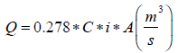 Equation 1
Where Q = Peak discharge (m3/s)
C = Runoff coefficient (dimensionless)
i = Rainfall intensity (mm/Hr.)
A = Watershed total area (km2)
In this rational method, to calculate the runoff coefficient C if different land use land cover of different infiltration will occur we can take the weighted runoff coefficient (Cw) instead of using single C. Therefore, the above rational method formula will take Cw as follows.
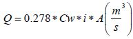 Equation 2
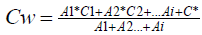 Equation 3
Where, Cw = is the weighted runoff coefficient.
Hydraulic Design 2
When a storm drain is not flowing full, it operates as an open channel and the hydraulic properties can be calculated using open channel techniques. The flow in a conduit operating as an open channel can be evaluated numerically using the Uniform Flow Equation. Concrete-lined channels are rectangular or trapezoidal channels in which reinforced concrete is used for lining the channel banks and/or bottom. Concrete-lined channels may be permitted only where existing right-of-way restrictions preclude the use of other channel types. Discharge is determined for known geometries of the drainage using one of discharge computation. Manning’s equation is one of the commonly used formula for uniform flow in an open channel, but the Manning’s roughness coefficient needs to be considered variable, dependent upon the depth of flow in that open channel and this Manning’s equation. This equation also used for calculating the cross-sectional area (A), wetted perimeter (P), and hydraulic radius (R) for flow of a specified depth in an open channel and pipe flow.
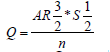 Equation 4
Where, Q = Peak or design discharge in the channel (m3/s)
A = is the wetted cross-sectional area (m2)
R = is the hydraulic radius (m)
n = is the roughness or manning’s coefficient (dimensionless) and
S = is the bed slop of the channel (m/m)
Intensity–Duration–Frequency Curves (IDF)
An intensity-duration-frequency curve (IDF curve) is a mathematical function that relates the rainfall intensity with its duration and frequency of occurrence. These curves are commonly used in hydrology for flood forecasting and civil engineering for urban drainage design. However, the IDF curves are also analyzed in hydrometeorology because of the interest in the time concentration or time-structure of the rainfall [13]. For this study, Intensity duration frequency (IDF) was developed from storm events of 21 years from 1987-2007 for different durations of 5 min, 15 min, 30 min, 45 min, 1 hr, 2 hrs, 3 hrs, 12 hrs and 24 hrs. The return period of the maximum annual rainfall frequency also developed. From the intensity duration frequency (IDF) curves, the following table summarized (Table 1 and Figure 4).

Figure 4. Intensity Duration frequency (IDF) curves of the study area.
| Duration/Return period | 2 | 5 | 10 | 15 | 20 | 25 | 50 | 100 |
|---|---|---|---|---|---|---|---|---|
| 5 min | 24.93 | 18.12 | 14.72 | 12.48 | 7.36 | 5.19 | 1.36 | 0.80 |
| 30 min | 25.19 | 18.31 | 13.45 | 11.40 | 6.72 | 4.74 | 1.24 | 0.73 |
| 45 min | 21.20 | 15.41 | 9.93 | 8.42 | 4.96 | 3.50 | 0.92 | 0.54 |
| 1 hr | 23.37 | 16.98 | 9.74 | 8.26 | 4.87 | 3.43 | 0.90 | 0.53 |
| 2 hr | 22.06 | 16.03 | 8.95 | 7.59 | 4.48 | 3.16 | 0.83 | 0.49 |
| 3 hr | 23.71 | 17.23 | 8.85 | 7.51 | 4.42 | 3.12 | 0.82 | 0.48 |
| 12 hr | 25.54 | 18.56 | 8.85 | 7.50 | 4.42 | 3.12 | 0.82 | 0.48 |
| 24 hr | 31.45 | 22.86 | 8.77 | 7.44 | 4.38 | 3.09 | 0.81 | 0.48 |
Table 1. Intensity duration frequency (IDF) curves of the study area.
Research methods flowchart
The general flowchart that shows the detailed procedures or steps is conceptualized as indicated in Figures 2-4. In this study, both primary and secondary data were used in assessing the existing stormwater runoff drainage system by integrating the hydrological model and hydraulic design.
At first instance, the hydrological model was done and the peak discharge determined using the rational method, and secondly, the hydraulic design was done using manning’s equation to determine the stormwater drainage capacity. The result obtained from the hydrological model compared with that of hydraulic design and final judgment was made. Judgment was made from different perspectives like improper management and alignment design of the existing stormwater runoff drainage system (Figure 5).

Figure 5. The general flowchart of the method.
According to the result of this study, the existing stormwater runoff drainage services are inadequate to carry the peak or maximum discharge for the return period by which this peak discharge will happen. Due to the ignorance of hydrological model or watershed model during the design of the drainage system, it failed to convey the excessive stormwater with considering hydraulic design only. At first instance, the existing drainage system was conveying all entering stormwater, but after few years it became fail to convey because additional excessive stormwater is entering into the drainage system which is contributed by the watershed. The other issues assessed or identified in this study was, the mismanagement and improper drainage alignment that revealed the overland flow storing outside the drainage system and some of excess stormwater is not getting the drainage system. Additionally, even the existing drainage system were totally clocked by dirty materials and due to this reason the stormwater runoff is not the getting channel rather it simply flowing over the land and on roads. And also due to the topography or nature this Shambu town location, the speed of the runoff if very high and there is no the probability to infiltrate to the soil. Finally, this study concluded that the assessment of the stormwater runoff drainage system needs proper management of the watershed, and giving awareness for the community on the existing drainage system is the state-of-art of the modern way of keeping the urban area safely.
Journal of Civil and Environmental Engineering received 1798 citations as per Google Scholar report


